Showing all 12 results
-
 Old maps€120,00
James Basire (1730-1802)
Mons, The Capital City Of Hainault In Ye Low Countries (c. 1745)
-
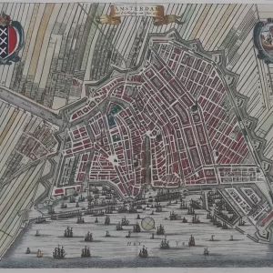 Old maps€500,00
Caspar Commelin (1668 – 1731)
Amsterdam with d’uytlegging van ‘t Jaer 1613 (1693)
-
 Old maps€1.200,00
Johann Baptist Homann (1664 – 1724)
Ichnographia Urbis in Tuscia primariae Florentiae (1731)
-
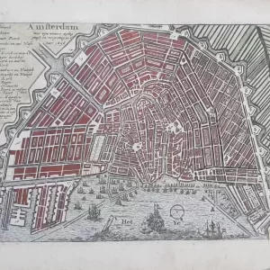 City maps€180,00
Jan Bouman (unknown – 1671)
Amsterdam met zyn niewe uytleggingh en vergrooting in ‘t jaar 1656 (1680)
-
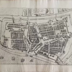
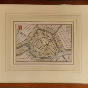 City maps€90,00
Caspar Merian (1627 – 1686)
Gouda (c. 1654)
-
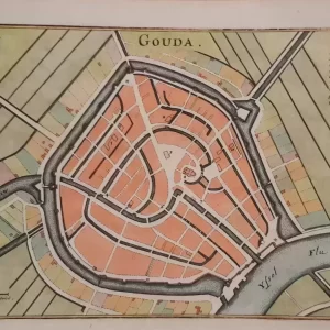 City maps€75,00
Caspar Merian (1627 – 1686)
Gouda (c. 1654)
-
 City maps€70,00
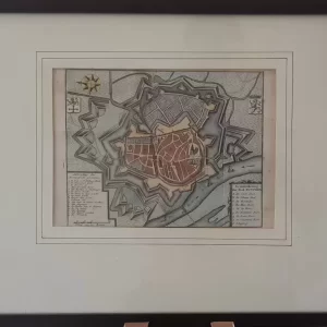
Isaak Tirion (1705 – 1765)
Ground plan of the city of Zutphen (ca. 1750)
-
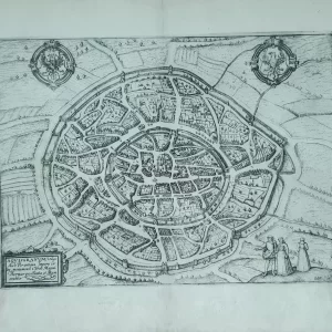
 City maps€325,00
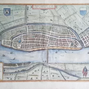
Frans Hogenberg (1535 – 1590) and Georg Braun (1541 – 1622)
Campen – Civitates Orbis Terrarum (1582)
-
 Europe€200,00
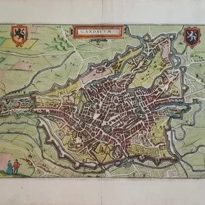
Lodovico Guicciardini (1512-1589)
Gandanum (1610)
-
 Old maps€50,00
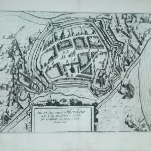
Lodovico Guicciardini (1521 – 1589)
Hic est situs oppidi rijberckgiæ (1612)
-
 Old maps€85,00
Lodovico Guicciardini (1521 – 1589)
AQVISGRANVM Vulgo Aich Per antiqua (1612)
-
 Old maps€85,00
Lodovico Guicciardini (1521 – 1589)
Ciuitas Embda (Emden) 1612