Showing 13–24 of 51 results
-
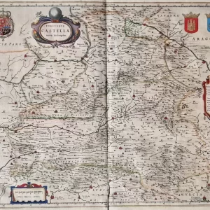 Old maps€225,00
Joan Willemsz. Blaeu (1598/99 – 1673)
Utriusque Castellae nova descriptio (c. 1635)
-
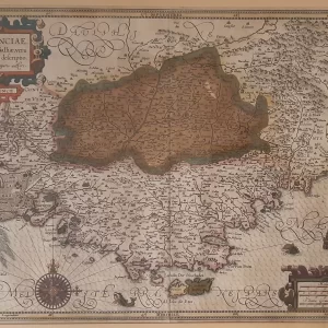
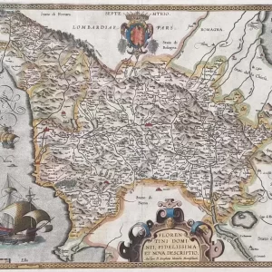 Old maps€950,00
Abraham Ortelius (1527 – 1598)
Florentini Dominii, Fidelissima et Nova Descriptio (1595)
-
 Old maps€1.200,00
Johann Baptist Homann (1664 – 1724)
Ichnographia Urbis in Tuscia primariae Florentiae (1731)
-
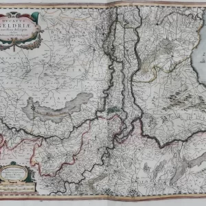 Old maps€350,00
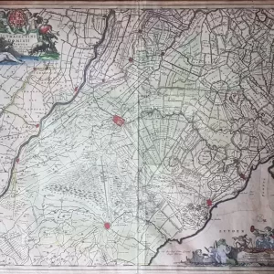
Henricus Hondius (1597 – 1651)
Dvcatvs Geldriæ novissima descriptio (1629)
-
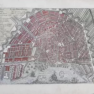 City maps€180,00
Jan Bouman (unknown – 1671)
Amsterdam met zyn niewe uytleggingh en vergrooting in ‘t jaar 1656 (1680)
-
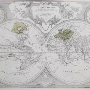 Old maps€800,00
Tobias Conrad Lotter (1717 – 1777)
Mappa Totius Mundi (1775)
-
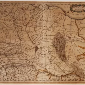 Old maps€375,00
Willem Jansz. Blaeu (1571 – 1638)
Ultraiectum Dominium (c. 1640)
-
 Old maps€450,00
Jodocus Hondius (1563 – 1612)
Provinciae Regionis Galliae, vera exactissima descriptio (1613)
-
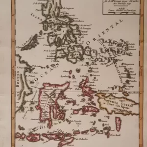 Old maps€150,00
Gilles Robert de Vougondy (1688 – 1766)
Isles Philippines et Moluques (1749)
-
 Old maps€550,00
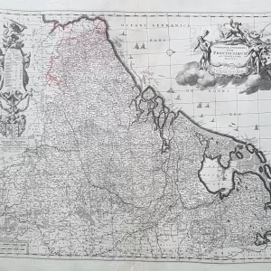
Henricus Hondius (1597 – 1651)
Comitatus Hollandiae (1633)
-
 Old maps€450,00
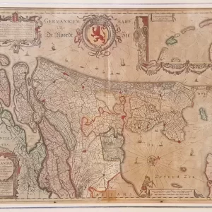
Nicolaes Visscher II (1649-1702)
Germaniae Inferioris XVII Provinciarum Accuratissima Tabula (1686)
-
 Old maps€200,00
Nicolaes Visscher II (1649-1702)
Ultraiectini Dominii Tabula (1687)