-
World maps€150,00
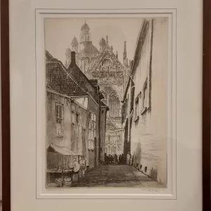
Hendrik de Laat (1900 – 1980)
Farmer’s sleeve ‘s Herthogenbosch (1929)
-
World maps€50,00
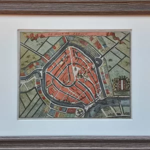
Jacobus Harrewijn (1660 – 1727)
La ville de Tergou (1743)
-
World maps€130,00
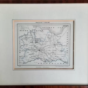
Jacob Kuyper (1821 – 1908)
Province of Utrecht (1866)
-
World maps€550,00
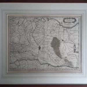
Willem Jansz. Blaeu (1571 – 1638)
Ultrajectum Dominium (c. 1640)
-
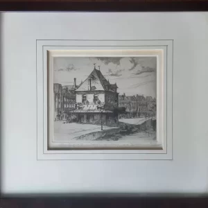
World maps€50,00
Johan Hemkes (1894 – 1988)
The Waag Leeuwarden (ca. 1935)
-
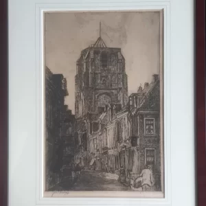
World maps€125,00
Johannes Elsinga (1893 – 1969)
Oldehove in Leeuwarden seen from the Grote Kerkstraat (ca. 1930)
-
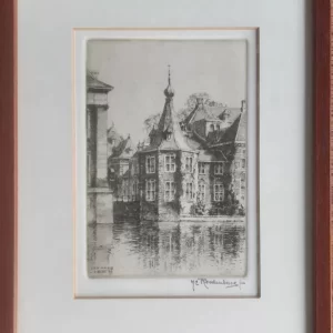
World maps€50,00
Hendrikus E. Roodenburg (1895 – 1987)
Buitenhof turret (1969)
-
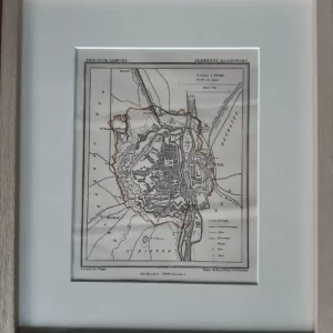
World maps€80,00
Jacob Kuyper (1821 – 1908)
Municipality of Maastricht (1865)
-
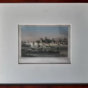
World maps€60,00
Johannes Leonardus Terwen (1813 – 1873)
DORDRECHT View from the other side of the river (1858)
-
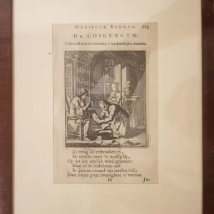
World maps€45,00
Jan Luyken (1649 – 1712) and Casper Luyken (1672 – 1708)
The Surgeon General (c. 1700)
-
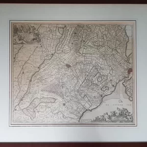
World maps€275,00
Johannes Covens I (1697 – 1774) and Cornelis Mortier (1699 – 1783)
Ultraiectini Dominii Tabula (1740)
-
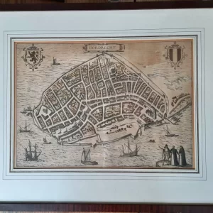
World maps€300,00
Georg Braun (1541 – 1622) and Frans Hogenberg (1535 – 1590)
Dordrecht (1580)
Shopping Cart