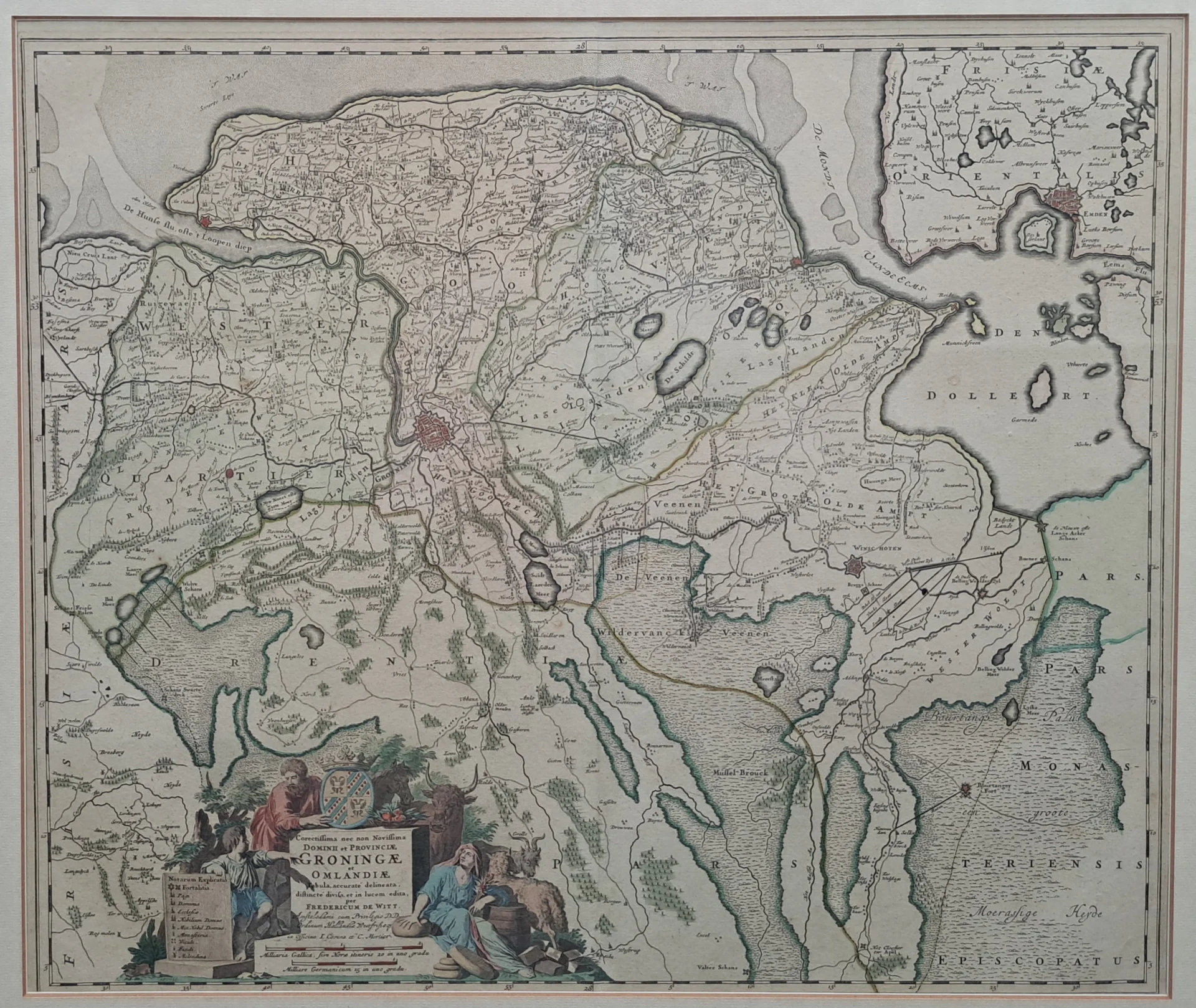
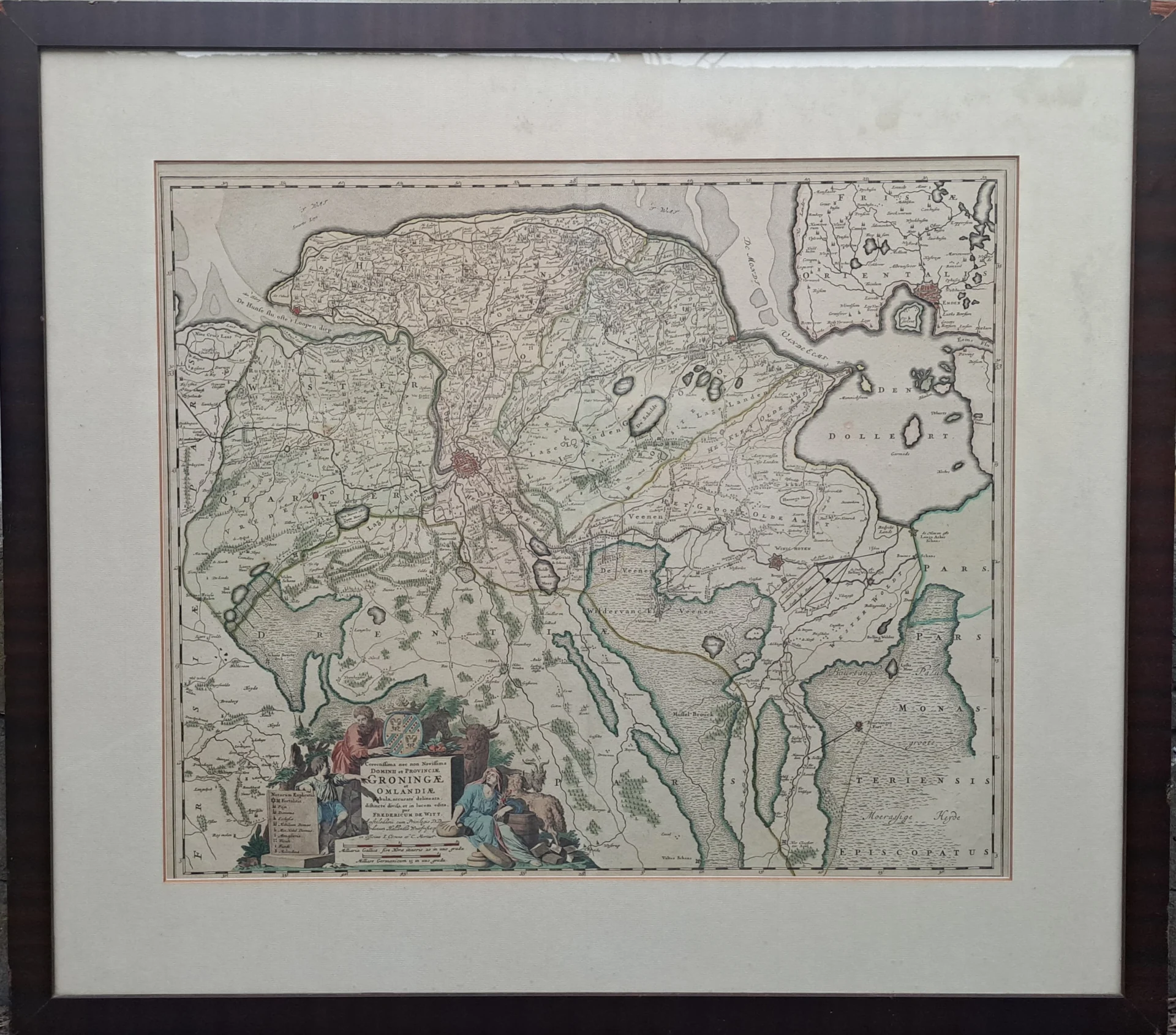
This map was originally designed and published by the Amsterdam cartographer Frederik de Wit and republished in 1725 by the renowned Amsterdam publishing house Covens & Mortier. Johannes Covens and Cornelis Mortier were prominent cartographic publishers in the18th century and acquired many of Frederik de Wit’s copper plates after his death.
- Image: this beautiful historical map shows the province of Groningen and the Ommelanden, with a detailed depiction of towns, waterways, borders, and the surrounding landscape. It provides a good overview of the geographical and administrative divisions of the Northern Netherlands in the seventeenth and early eighteenth centuries. A special map for lovers of Dutch cartography and the history of Groningen.
- year: 1725
- quality: excellent
- signed: printed on plate
- picture dimensions: 49.5 x 58.5 cm | 19.5 x 23.0 in (h x w)
- dimensions of the sheet or frame: 71.0 x 79.8 cm | 28.0 x 31.4 in (h x w)