Ergebnisse 133 – 144 von 146 werden angezeigt
-
 Alte Karten€550,00
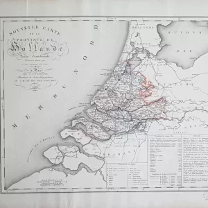
Cornelis van Baarsel (1761 – 1826)
Nouvelle Carte de la Province de Hollande partie Méridionale (1818)
-
 Alte Karten€125,00
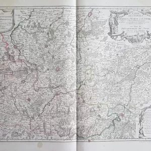
Guillaume Delisle (1675 – 1726)
Karte des Grafen von Hennegau, von Namur und von Cambresis (1790)
-
 Drucke€125,00
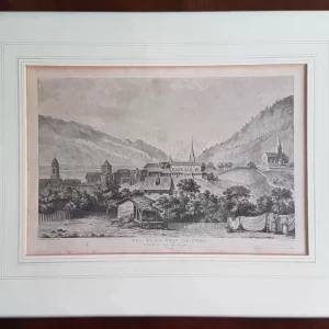
Michel Picquenot (1747-1808)
Blick auf die Stadt Coire (1780)
-
 Europa€200,00
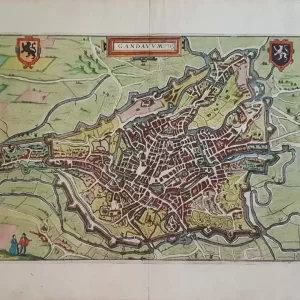
Lodovico Guicciardini (1512-1589)
Gandanum (1610)
-
 Alte Karten€350,00
Nicolaes Visscher II (1649-1702)
Flandriae Comitatus pars orientalis (1690)
-
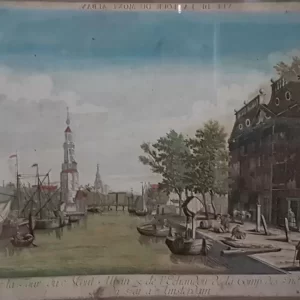 Stadtansicht€35,00
Balthasar Friedrich Leizelt (1750 – 1800)
Vuë de la Tour de Mont Alban & de l’Echaudoir de la Comp (ca. 1780)
-
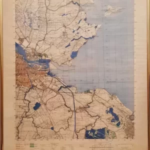 Alte Karten€100,00
Deutsche Stabskarte, kopiert von den Briten 1942, 1:50.000
Gebiet Amsterdam
-
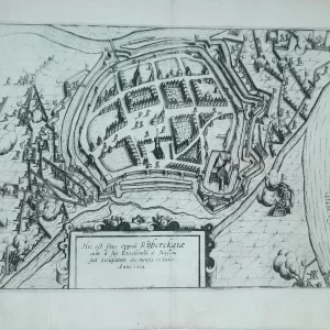 Stadtpläne€50,00
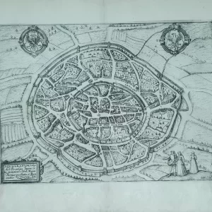
Lodovico Guicciardini (1521 – 1589)
Hic est situs oppidi rijberckgiæ (1612)
-
 Stadtpläne€85,00
Lodovico Guicciardini (1521 – 1589)
AQVISGRANVM Vulgo Aich Per antiqua (1612)
-
 Alte Karten€75,00
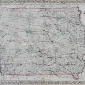
George Woolworth Colton (1827 – 1901)
Colton’s Iowa (1878)
-
 Alte Karten€90,00
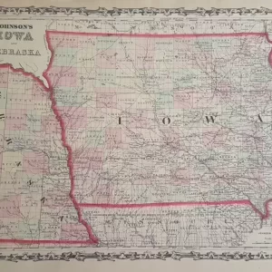
Alvin J. Johnson (1826 – 1884)
Johnsons Iowa und Nebraska (1855)
-
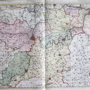
 Alte Karten€125,00
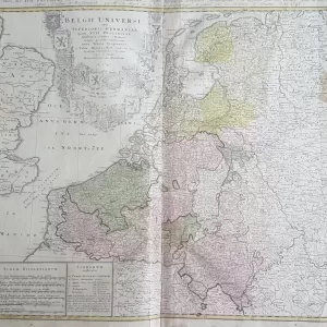
Johann Baptist Homann (1664 – 1724)
Belgii Universi seu Inferioris Germaniae (1747)